We remain fully operational. Our teams are working around the clock to ensure your deliveries continue safely.
Account
Desertcart PRO
تتبع الطلبات
قائمة الرغبات
إدارة الحساب
Browse categories
Desertcart PRO
تتبع الطلبات
قائمة الرغبات
إدارة الحساب
Desertcart Logo
KUWAIT
English
Account
Desertcart PRO
تتبع الطلبات
قائمة الرغبات
إدارة الحساب
Browse categories
Desertcart PRO
تتبع الطلبات
قائمة الرغبات
إدارة الحساب
Desertcart Logo
KUWAIT
English
Account
Desertcart PRO
تتبع الطلبات
قائمة الرغبات
إدارة الحساب
Browse categories
Desertcart PRO
تتبع الطلبات
قائمة الرغبات
إدارة الحساب
Desertcart Logo
KUWAIT
English
العودة إلى الأعلى
تسوق لايكا Ts06 Plus في الإمارات|صناعي|تسوق عالميًا|ديزرت كارت - Page 3
صناعي
تخطيط القياس
محطات إجمالية
لايكا
تسوق Leica Ts06 Plus مع خدمة التوصيل العالمية - الصناعية - Page 3
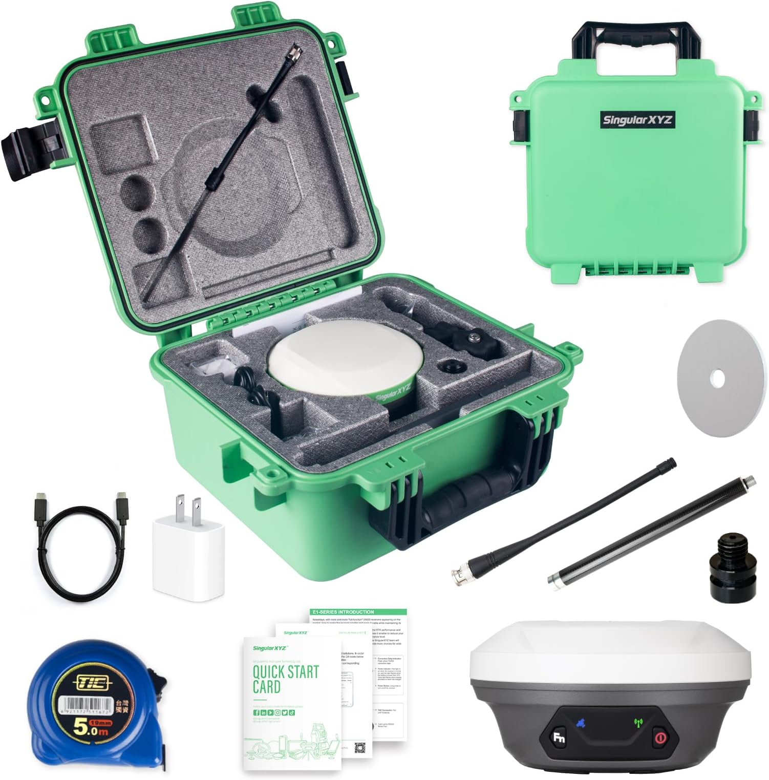
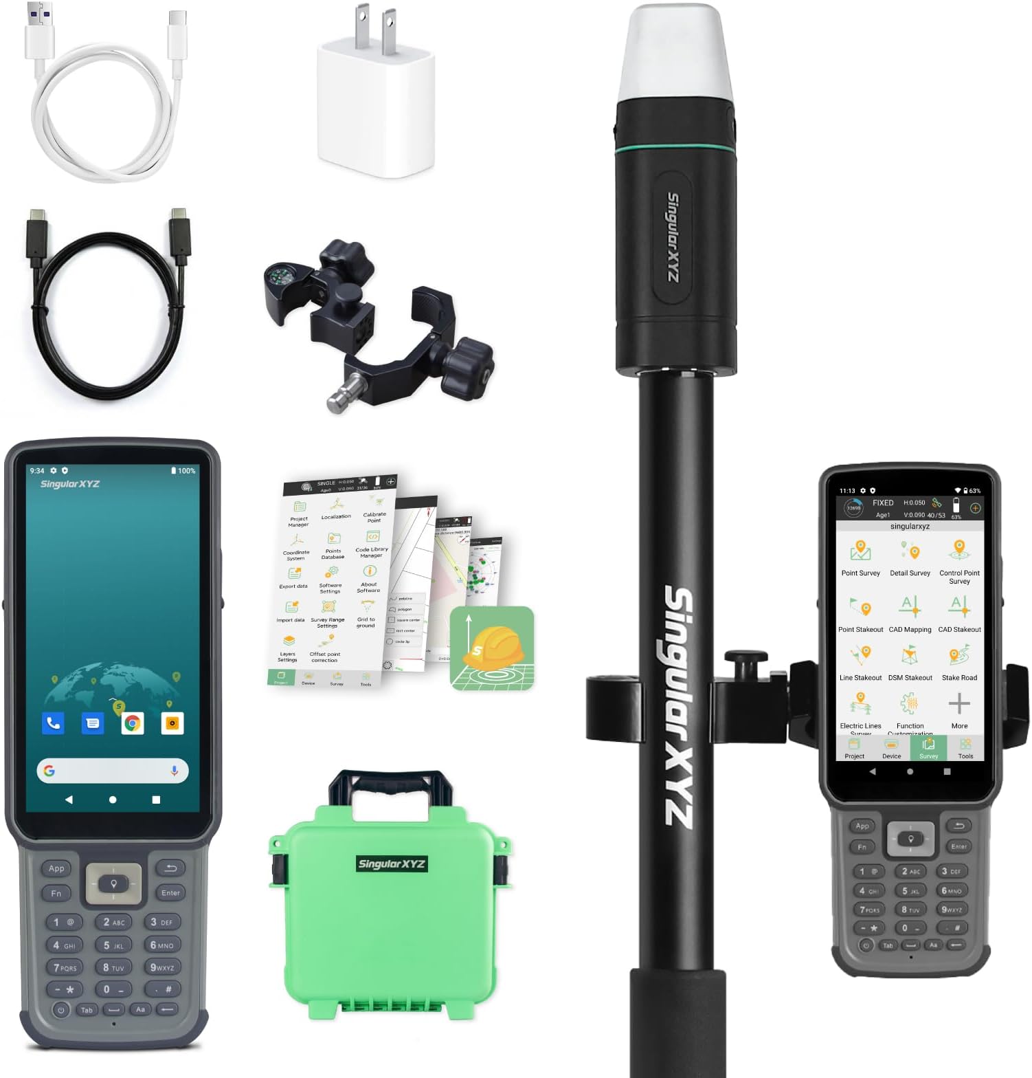
E1 Lite GNSS RTK Surveying Equipment, RTK GNSS GPS with IMU Rover & Base, GPS RTK Handheld Collector with Software, 1cm Accuracy, 1408 Channels, 60° Tilt Survey, 5km UHF Range
KUWAIT
Store
KD 1148.96
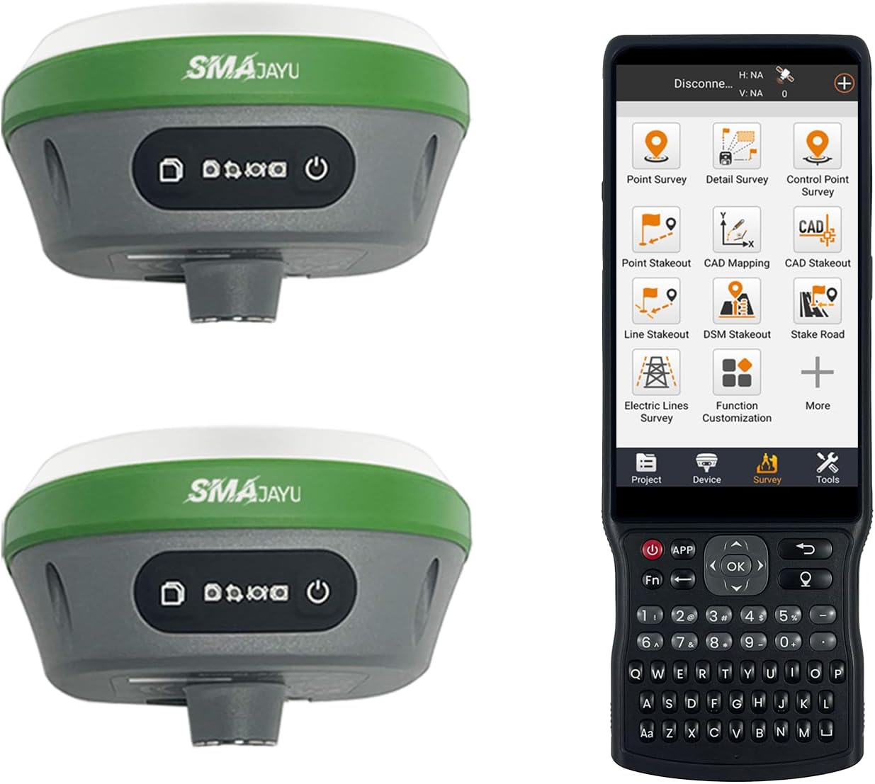
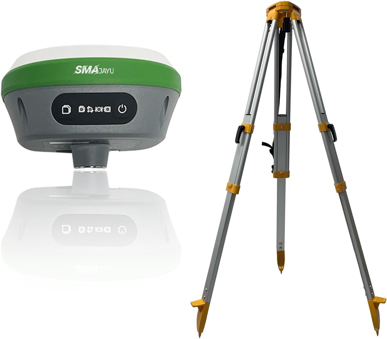
IMU RTK GPS Survey EQUIPEMNT 1cm Accuracy Kilometers Distance Between SMA26 PRO RTK Rover and RTK Base, 0-30° Tilt Surveying, NOAA Certificated (Include Tripod, Pole&Tribrach)
« Prev
1
2
3
4
5
Next »
KUWAIT
Store
KD 1714.97
GPS Land Surveying Equipment With 2.8'' LCD Color Screen, Rechargeable High Accuracy, For Forest Farmland Mountain Mining Lake Area And Distance Measurement
KUWAIT
Store
KD 1.43
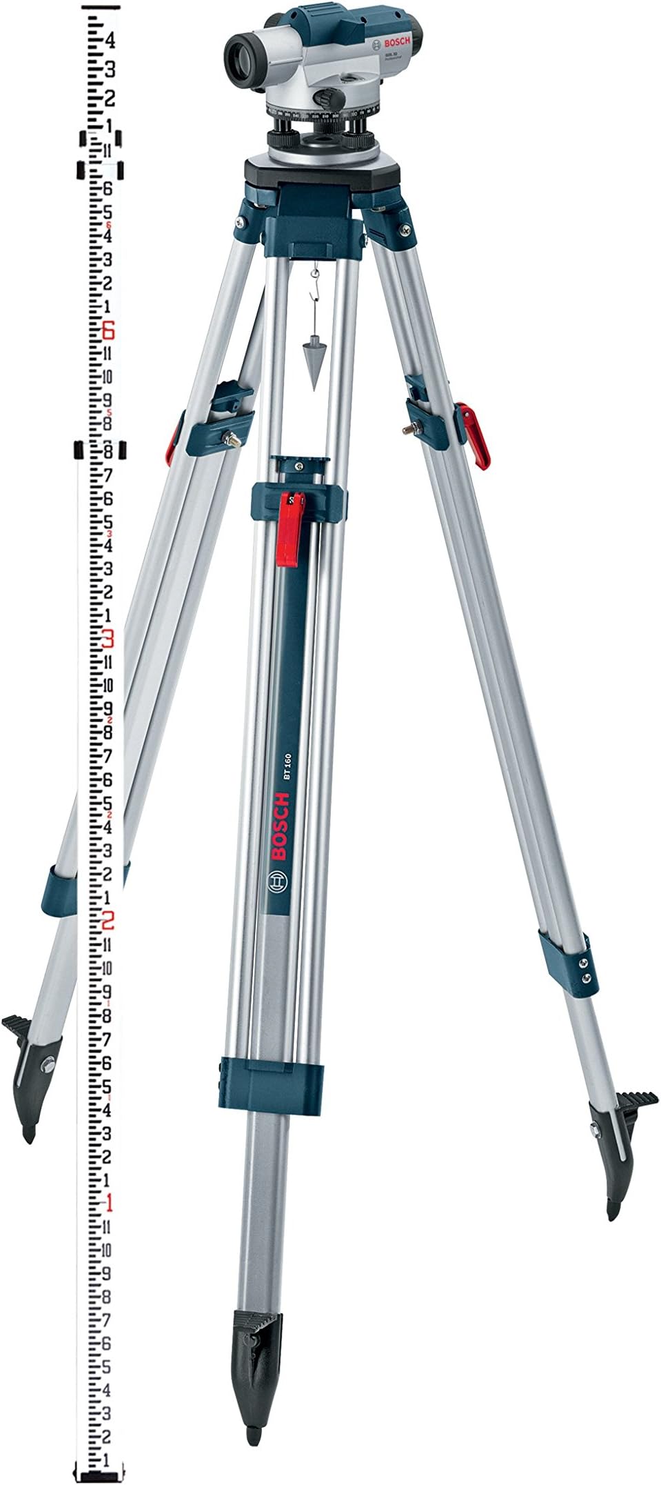
BOSCH GOL 32CK 32X Automatic Optical Level Kit, Includes Aluminum Tripod, Grade Rod, Plumb Bob, Tool Kit, & Carrying Case
KUWAIT
Store
KD 183.14
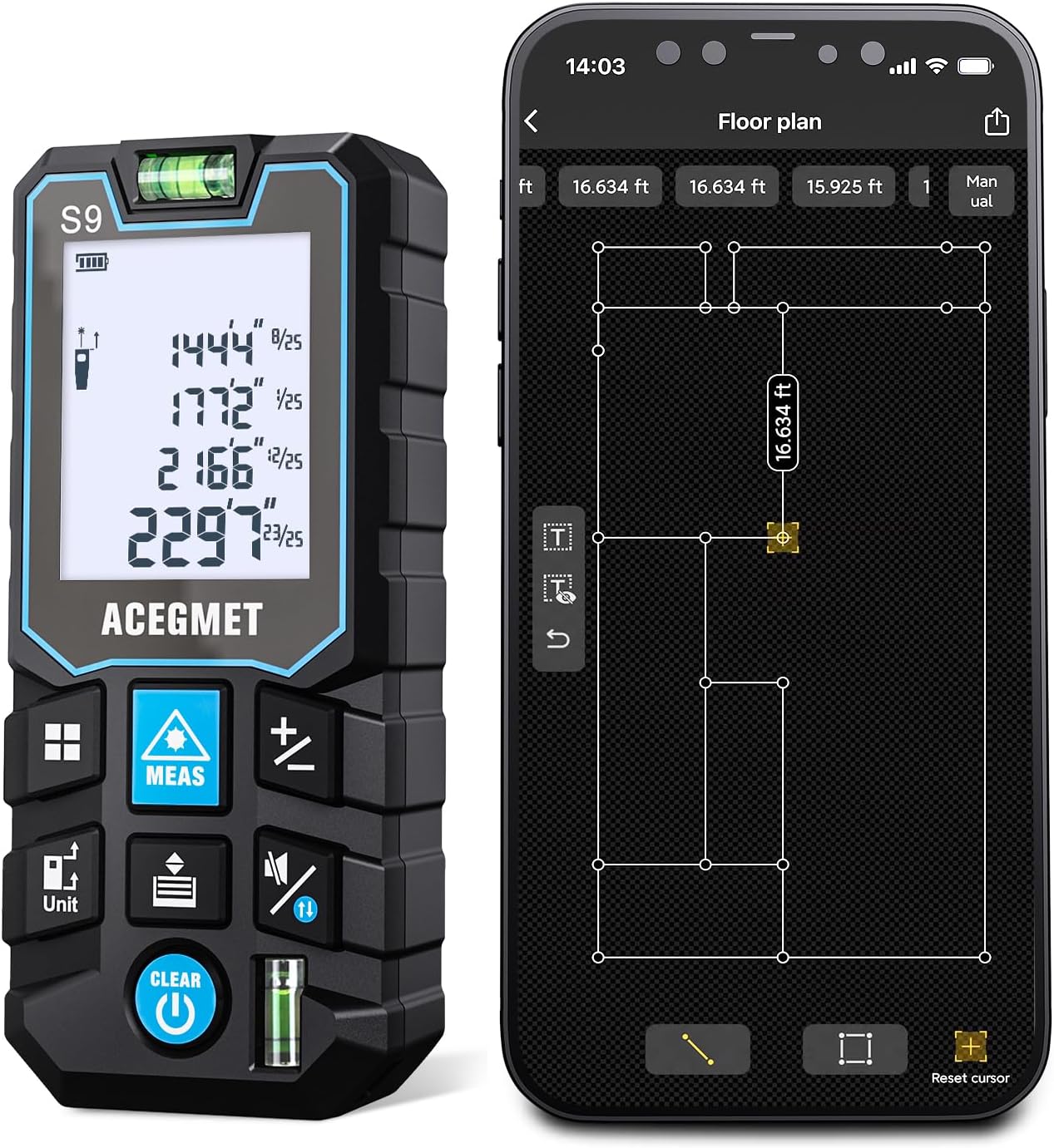
Laser Measure with Phone App, 229ft/70m Laser Measurement Tool with 2 Bubble Levels, LCD Backlit Display, IP54 Waterproof, Pythagorean Mode for Distance, Area, Volume
KUWAIT
Store
KD 18.90
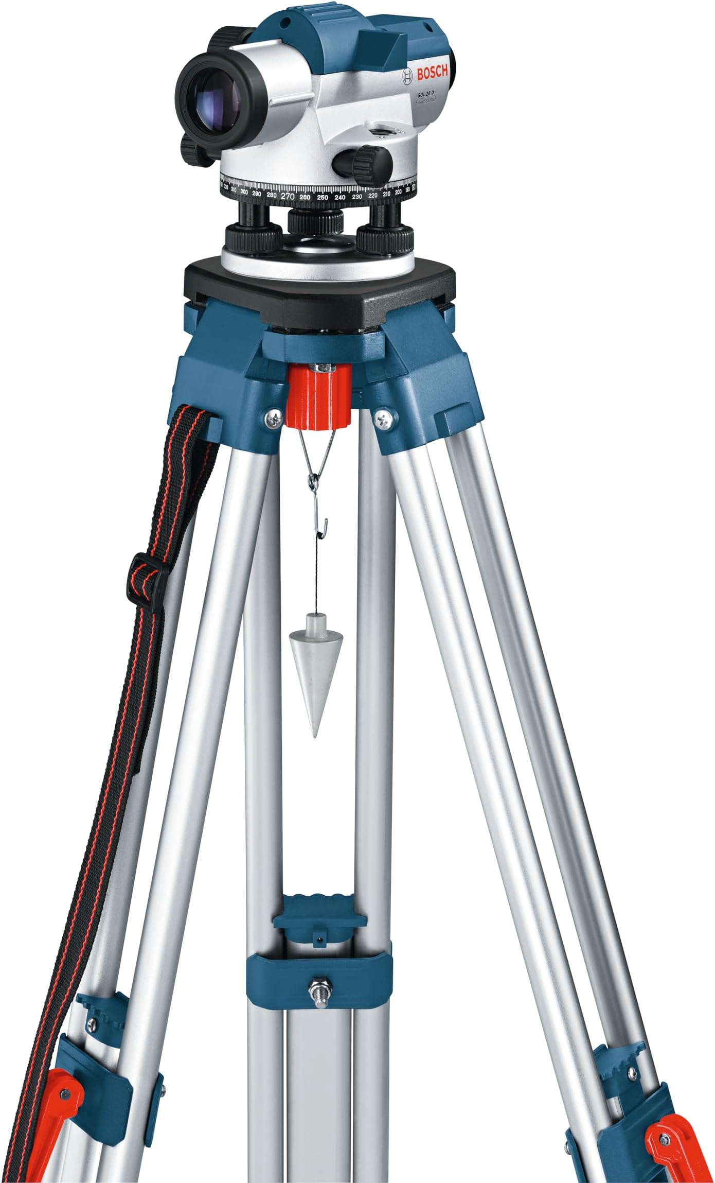
Bosch Professional Optical Level GOL 26 D (26x magnification, unit of measure: 360 degrees, range: up to 100m, in carrying case)
KUWAIT
Store
KD 6.11
GOL26 26X Automatic Optical Level
KUWAIT
Store
KD 74.14
- IMU RTK GPS Survey EQUIPEMNT 1cm Accuracy Kilometers Distance Between SMA26 PRO RTK Rover and RTK Base, Work as Base Station for Drones, 0-60° Tilt Surveying(Include Tripod, Pole&Tribrach)
KUWAIT
Store
KD 1445.92
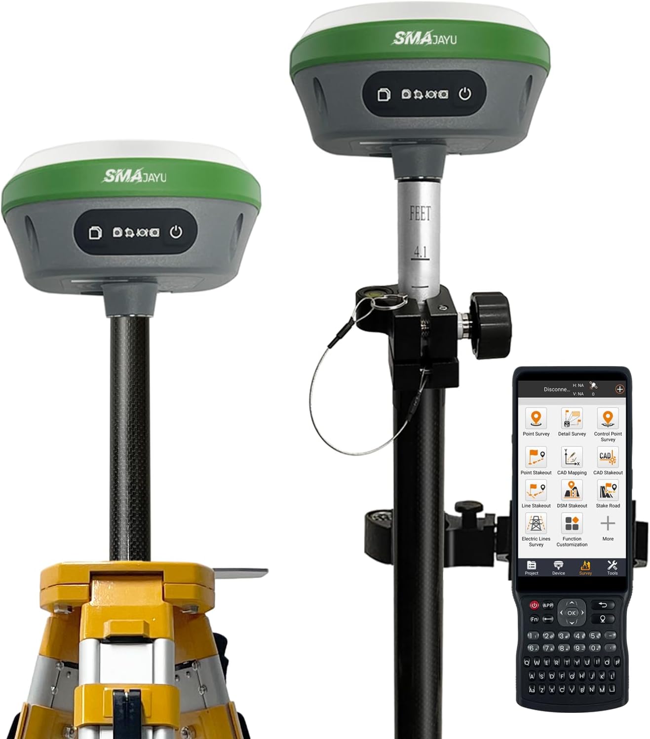
SMA26 Pro Rover GNSS Receiver RTK Surveying System with Controller and Software, Work as Base Station for Drones,10000mAh,32GB,4G/BT/WiFi,Ideal for Construction & Engineering(Include Pole)
KUWAIT
Store
KD 829.49
SMA26 Plus RTK GPS Survey Equipment RTK Rover Base, Handheld Collector with Survey Software, Static Survey, PPP, PPK Survey, Tilt Compensation, NOAA certificated (Exclude Pole&Tripod)
KUWAIT
Store
KD 1478.63
E1 Gnss Gps Rtk Base Station Land Surveying Equipment Total Receiver High Accuracy Static Surveying, Coodinates Collection, Point
KUWAIT
Store
KD 613.13
SMA26 RTK GNSS GPS Surveying Equipment with IMU Rover & Base, 1408 Channels, 0.5cm Accuracy, Upto 10km Range, NOAA Certified, Handheld Collector & Survey Software (Tripod & Pole Not Included)
KUWAIT
Store
KD 1562.90
HOZO M-Cube Laser Measuring Tool Adaptor, 01 Smart Planner - Features 360° Joystick for Capturing Floorplans from Any Angle, One-Tap Button for Precise Edge and Corner Measurements
KUWAIT
Store
KD 54.81
R26 V1 GNSS GPS RTK Base Station for RTK Rover, Drone,Static Point Surveying,Coordinates stakeout(Exclude Tripod)
KUWAIT
Store
KD 939.61
Xiaomi Smart Laser Measure 36764
KUWAIT
Store
KD 26.55
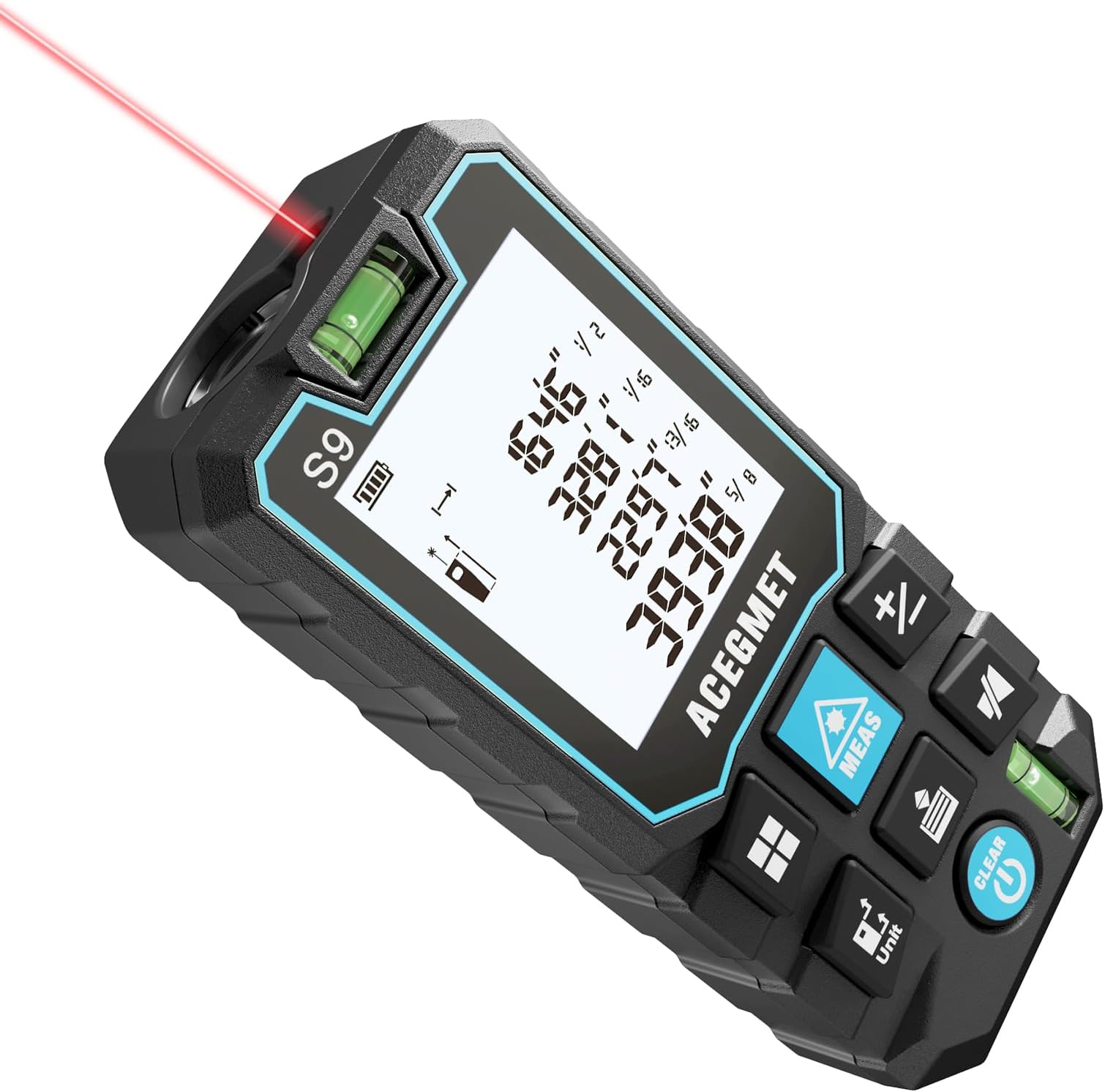
70m Laser Measure with Phone App, Laser Measurement Tool, S9 Room Laser Measuring Tool with 2 Bubble Levels, LCD Backlit Display, IP54 Waterproof, Pythagorean Mode for Distance, Area, Volume
KUWAIT
Store
KD 18.49
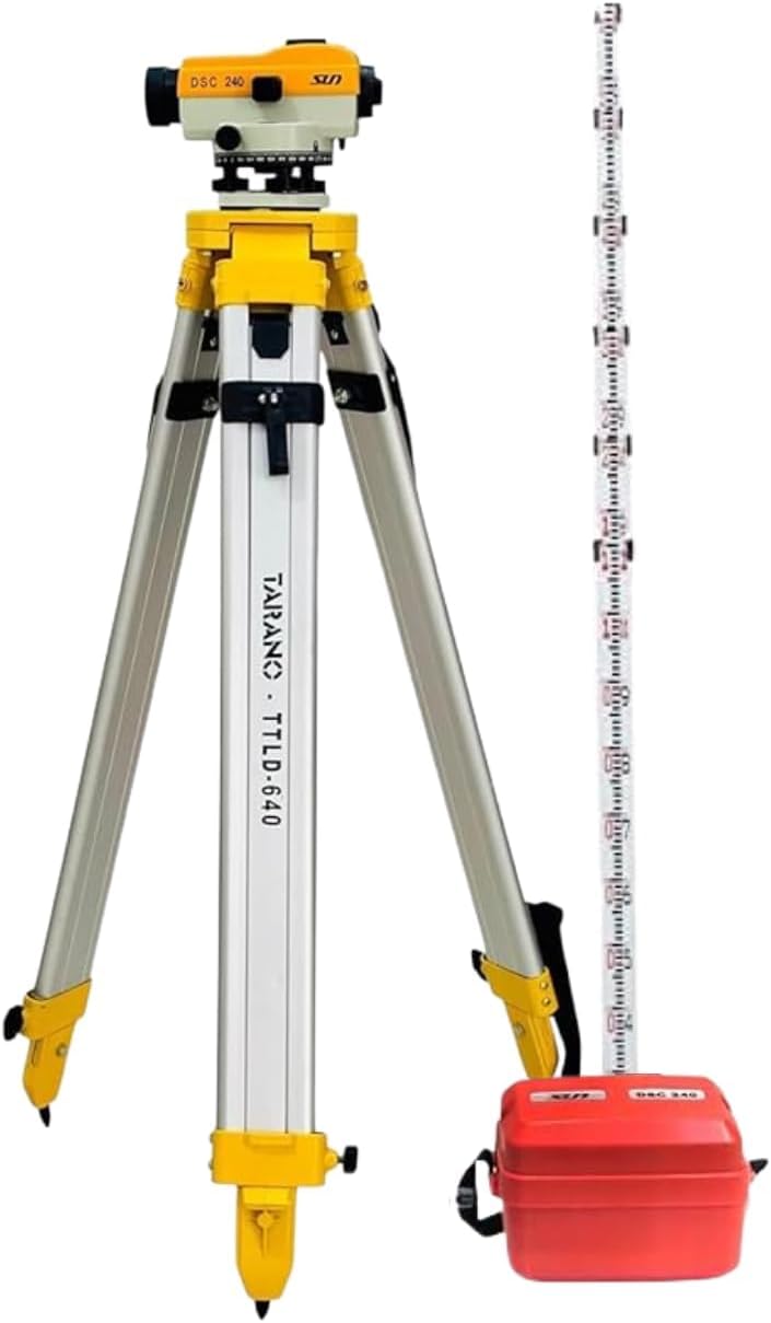
UK SURVEY INSTRUMENT SUN AUTO LEVEL DSC-240, 4mtr leveling staff with Free auto level plastic box and Aluminium Tripod use for Survey Instrument (COMPLETE Pack of 1)
KUWAIT
Store
KD 19.71
Professional Optical Level GOL 26 D (26x Magnification, Unit of Measure: 360 Degrees, Range: up to 100m, in Carrying case)
KUWAIT
Store
KD 120.97
BOSCH GOL 32CK 32X Automatic Optical Level Kit, Includes Aluminum Tripod, Grade Rod, Plumb Bob, Tool Kit, & Carrying Case
KUWAIT
Store
KD 200.55
GOL 32D 32x Optical Level Kit with Indian Make Tripod and Levelling Staff
KUWAIT
Store
KD 111.73
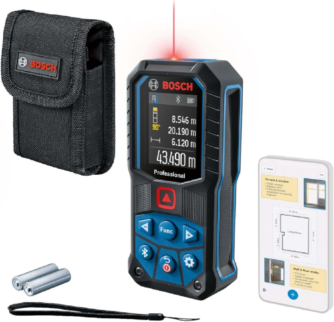
Bosch Professional Laser Measure Glm 120 C (Integrated Camera, Data Transfer Via Bluetooth, Range: 0.08–120 M, Carrying Strap, Micro Usb Cable And Charger)
KUWAIT
Store
KD 206.58
HOZO M-Cube Laser Measuring Tool Adaptor 03 Bilateral Laser+,328ft/100m Modular Dual Laser Distance Meter with Bluetooth App and M-Green Cross Line, Ideal for Surveying,Construction, DIY Projects
KUWAIT
Store
KD 53.56
Professional Optical Level GOL 26 D (26x magnification, unit of measure: 360 degrees, range: up to 100m, in carrying case)
KUWAIT
Store
KD 81.49
E1 Lite GNSS RTK GPS Surveying Equipment - 1408-Channel RTK Rover for High-Accuracy Measurement, Ground Detection, and Topographic Mapping with SC200 Manifold and Software
KUWAIT
Store
KD 733.68
New GEB221 Li Ion Battery for TS02 TS06 TS09 TPS1200 Total Stations G.P.S
KUWAIT
Store
KD 26.99
ACEGMET Laser Measure with Phone App, 229ft/70m Laser Measurement Tool with 2 Bubble Levels, Bluetooth, LCD Backlit Display, IP54 Waterproof, Pythagorean Mode for Distance, Area, Volume
KUWAIT
Store
KD 26.91
Rtk Gnss Survey Equipment With Network Rover, Handheld Controller And Software, Gps 60° Tilt Built-In Imu, For Construction Geodetic Or Land Layout Planning
KUWAIT
Store
KD 859.92
Laser Measure, 393ft/120m Laser Measurement Tool, Laser Measuring Tool with 2 Bubble Levels, LCD Backlit Display, IP54 Waterproof, Pythagorean Mode for Distance, Area, Volume
KUWAIT
Store
KD 11.63
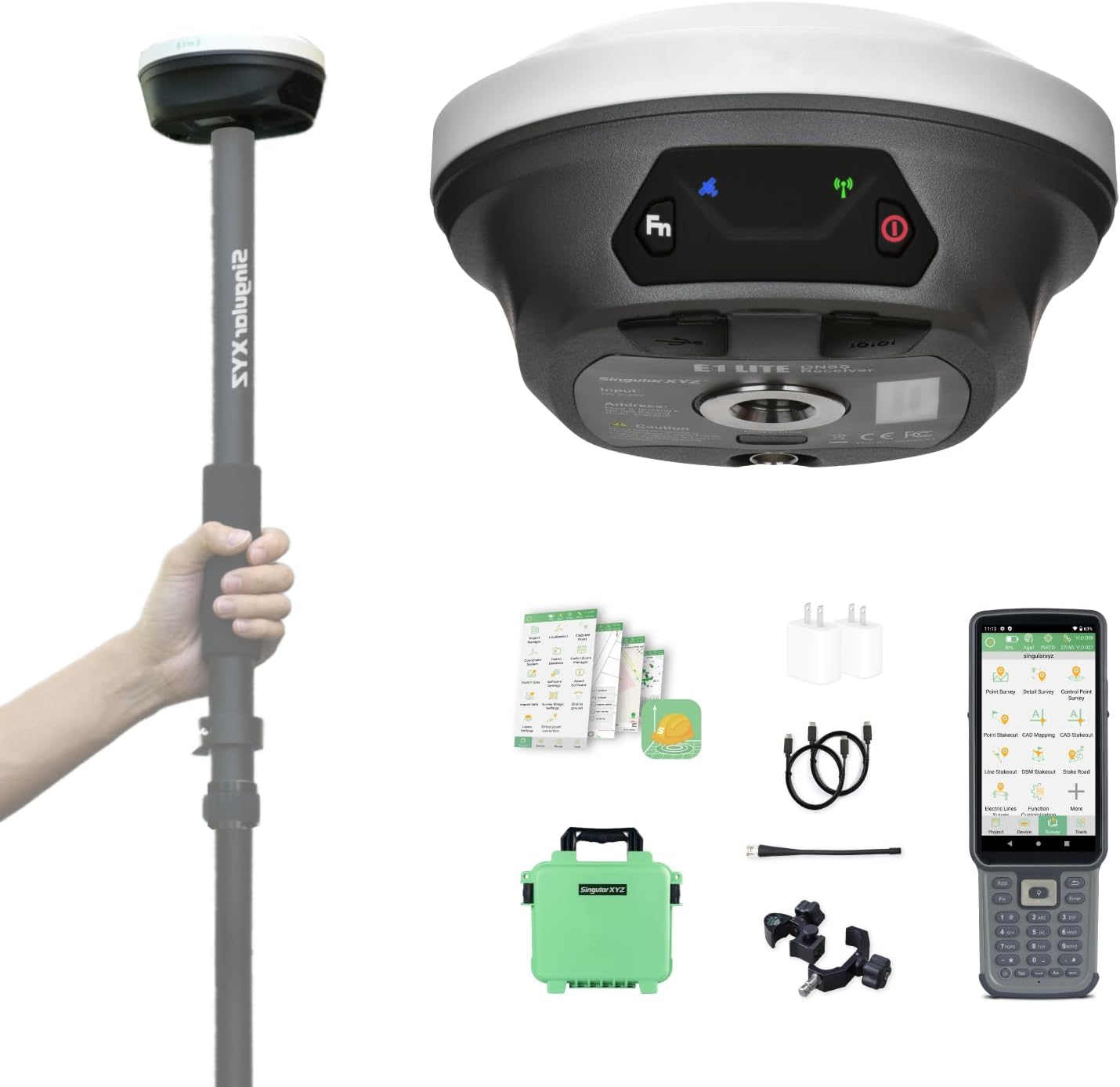
E1 Lite GNSS RTK GPS Surveying Equipment – 1408 Channels RTK Rover for High-Precision Measurement, Land Survey, Topographic Mapping, CORS Correction, with SC260 Collector & Software, FCC Certified
KUWAIT
Store
KD 483.56
Laser Measurement Tool with Phone App, Record Data+2D Floor Plan Laser Tape Measure ACEGMET 196 Feet Laser Measure , ±1/16-inch Accuracy, Ft/in/Ft+in/M Unit Switch and 6 Modes of The Measurement
KUWAIT
Store
KD 31.46
E1 GNSS GPS RTK Base Station Land Surveying Equipment Total Station GNSS Receiver High Accuracy Static Surveying, Coodinates Collection, Point Surveying
KUWAIT
Store
KD 455.22
Bosch Professional Laser Measure GLM 50-27 C (Range: up to 50m, Robust, IP65, Data Transfer via Bluetooth, 2x AA Batteries, Hand Strap, Pouch)
KUWAIT
Store
KD 87.53
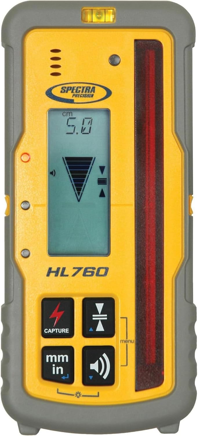
Spectra Precision HL760 Receiver - Yellow
KUWAIT
Store
KD 292.20
Sfaira Plus RTK Rover with a Pole
KUWAIT
Store
KD 609.54
E1 GNSS GPS RTK Base Station Land Surveying Equipment Total Station GNSS Receiver High Accuracy Static Surveying, Coodinates Collection, Point Surveying
KUWAIT
Store
KD 652.69
BoschGOL 32CK 32X Automatic Optical Level Kit, Includes Aluminum Tripod, Grade Rod, Plumb Bob, Tool Kit, & Carrying Case
KUWAIT
Store
KD 284.95
RTK GNSS Survey Equipment with Network RTK Rover, Handheld Controller and Survey Software, GNSS RTK GPS with 60° Tilt and Built-in IMU, for Construction and Geodetic or Land Survey Layout Planning
KUWAIT
Store
KD 630.69
SMA26 RTK Base Station High-Precision GNSS Receiver NOAA certificated (Included Surveying Tripod)
KUWAIT
Store
KD 539.91
GOL26 26X Automatic Optical Level, Includes Plumb Bob, Tool Kit, & Carrying Case
KUWAIT
Store
KD 127.67
M-Cube Laser Measuring Tool Adaptor 03 Bilateral Laser+,328ft/100m Modular Dual Laser Distance Meter with Bluetooth App and M-Green Cross Line, Ideal for Surveying,Construction, DIY Projects
KUWAIT
Store
KD 35.81
SMA26 Plus GNSS RTK Rover & Base Surveying Equipment with Controller and Software, Connect with UAVs,1cm Accuracy, NOAA Certified, IMU/PPP/UHF/NTRIP/BT, IP67 GPS for Civil Engineering and Topography
KUWAIT
Store
KD 1135.42
SMA26 GNSS IMU RTK GPS Surveying Equipment Rover Base Handheld Collector with Survey Software, NOAA Certificated, 1408 Channels, 1cm Accuracy, Kilometer Wireless Distance(exclude tripod&pole)
KUWAIT
Store
KD 1575.10
BOSCH GOL26 26X Automatic Optical Level, Includes Plumb Bob, Tool Kit, & Carrying Case
KUWAIT
Store
KD 162.10
Professional Laser Measure GLM 50-27 C with Bluetooth® connectivity | Model: 0601072T00 with 1 year warranty
KUWAIT
Store
KD 67.54
RTK GNSS Survey Equipment with Network RTK Rover, Handheld Controller and Survey Software, GNSS RTK GPS with 60° Tilt and Built-in IMU, for Construction and Geodetic or Land Survey Layout Planning
KUWAIT
Store
KD 814.95
Generic Land Surveying Equipment, Handheld GPS Land Meter, Professional GNSS Receiver Surveryor Tool with Color Screen for Slope Distance/Area Measurement
KUWAIT
Store
KD 51.15
E1 Lite GNSS RTK GPS Surveying Equipment – 1408 Channels RTK Rover for High-Precision Measurement, Land Survey, Topographic Mapping, CORS Correction, with SC200 Collector & Software, FCC Certified
KUWAIT
Store
KD 485.58
Bosch GOL 26 D-2 Plastic Professional Optical Level (Blue), 1 Piece
KUWAIT
Store
KD 63.85
BOSCH GOL26 26X Automatic Optical Level, Includes Plumb Bob, Tool Kit, & Carrying Case
KUWAIT
Store
KD 137.85
SUN INSTRUMENTS | SUN AUTO LEVEL DSC- 240WITH FREE PLASTIC BOX FOR AUTO LEVEL | INCLUDED 4 MTR LEVELING STAFF WITH ALUMINIUM DOUBLE LOCK TRIPOD STAND (2 LEVELING STAFF)
KUWAIT
Store
KD 54.24